Coastal flooding is possible this morning, dry week ahead
SAVANNAH, Ga. (WTOC) -Happy Monday!
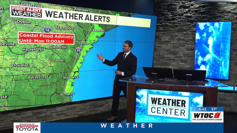
Our work and school week is starting out on a dry note with temperatures in the 50s this morning. It’ll be quiet for most of us, but we are watching the morning high tide.
Monday’s high tide is expected to be the highest of this coastal flooding event. The forecast is for a 10.0′ tide to occur at Fort Pulaski between 8-9 AM. Any time the tide gets near 10 feet, water could get onto Highway 80s.
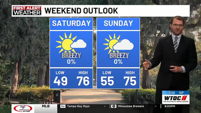
Temperatures will reach the upper 60s by lunchtime with highs in the mid to upper 70s. There will be plenty of sunshine with the breeze remaining from the northeast through the day.
Monday beach conditions: Today won’t be a good day to be along the coast. There is a high risk for rip currents. The wind will be blowing from the northeast at 15 to 20 miles per hour. Wave heights at the coast will range from 3 to 6 feet, with even larger waves offshore.
Tybee tides: High - 8:20 AM/Low -3:11 PM
Hilton Head tides: High - 8:30 AM/Low - 2:55 PM
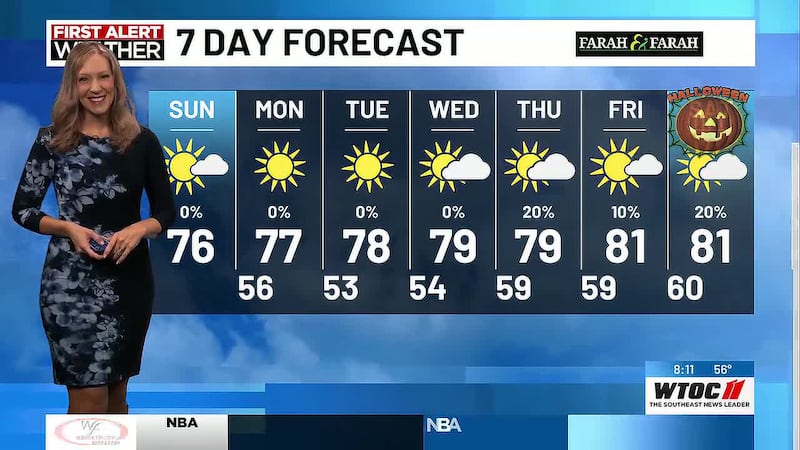
Quiet weather continues through the middle of the week, with slightly cooler air expected in the mornings. We’ll wake up to the upper 40s and lower 50s on Tuesday and Wednesday with highs in the upper 70s. We’ll warm up during the end of the week with morning lows in the lower 60s followed by highs near 80 degrees on Thursday and Friday.
Halloween is looking dry with morning lows in the lower 60s and highs near 80 degrees. It’ll be comfortable for trick-or-treating in the evening! Remember, we will turn our clocks back overnight into Sunday morning. Our next best chance for rain arrives on Sunday/Monday.
Copyright 2026 WTOC. All rights reserved.